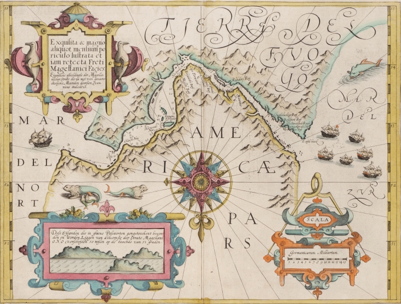
Southern tip of South America, Mercator-Hondius, 1606. This early Dutch chart of the southern tip of South America is from a 1606 Mercator-Hondius atlas. Its orientation with south at the top was not uncommon at the time it was made. The rectangular cartouche explains that some islands are located 50 miles (37 km) east-northeast of the entrance to the strait. The title cartouche reports that Magellan Straits is dangerous, but that the map has been corrected.
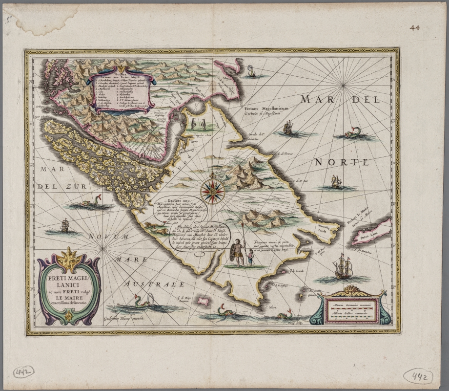
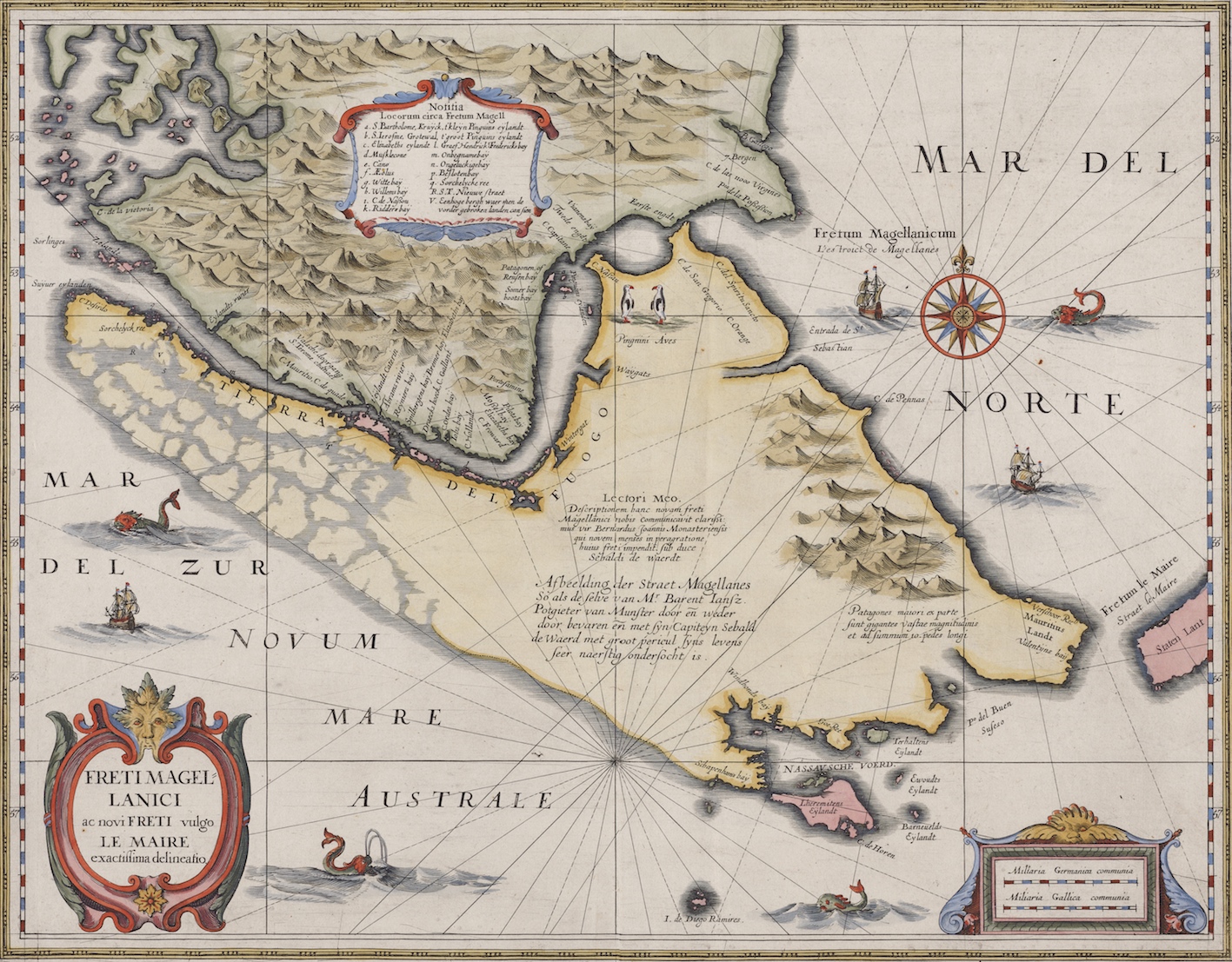
‘Magellan Straits and the new Strait described by Le Maire’, by William Blaeu and engraved by D. Grijp, 1630. The map was published only in the 1630 Appendix edition to the Atlas Novus and was replaced in the next edition. Barent Potgieter van Munster, who sailed with Sebald de Waerd through Magellan Straits supplied the information; after exiting the Strait, De Waerd immediately returned back through the Straits,to Holland in the vessel ’Geloof’. The description of Jacob Le Maire with Staten Lant (only recognised in 1643 as an island) etc. was added, showing a normal west coast of Tierra del Fuego. The Patagonian Giants are shown with a text that they are 10 feet tall (’10 pedes’), probably caused by the size of their footprints, wearing snowshoes.
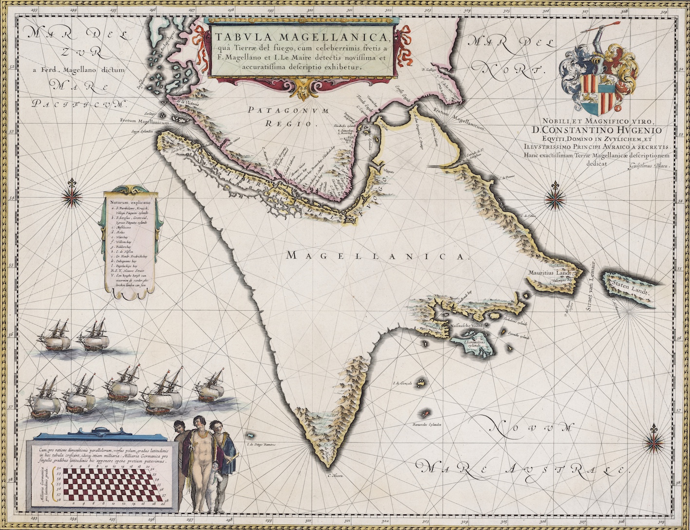
Tierra del Fuego [Magellanica] and Patagonia, William Blaeu. Another chart by Blaeu of the same region. This one is dedicated to Constantin Huygens, the famous Dutch scientist and mathematician, inventor of the pendulum clock. It shows Tierra del Fuego [Magellanica] and Patagonia, without much interior information.
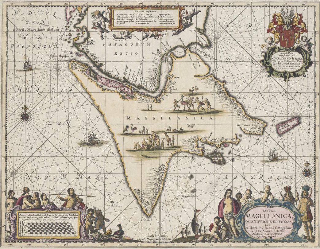
Tabula Magellanica or Tierra del Fuego, Pieter Schenk and Gerard Valk, published between 1686 and 1719. The original copperplate was made by Joannes Janssonius in 1644 but looks very much like a derivative of the earlier Blaeu plate; it is now dedicated to Wouter de Raet, eminent senator in West-Friesland. Scale bars shown are latitude-specific, Staten Landt has been corrected to Staten Eylandt with a G. Brouwers passage to its west, resulting from the 1643 voyage by Hendrick Brouwers. The cartouches show local animals (penguins) and native inhabitants with feathered headdress). The empty interior of Magellanica is filled with people and animals.
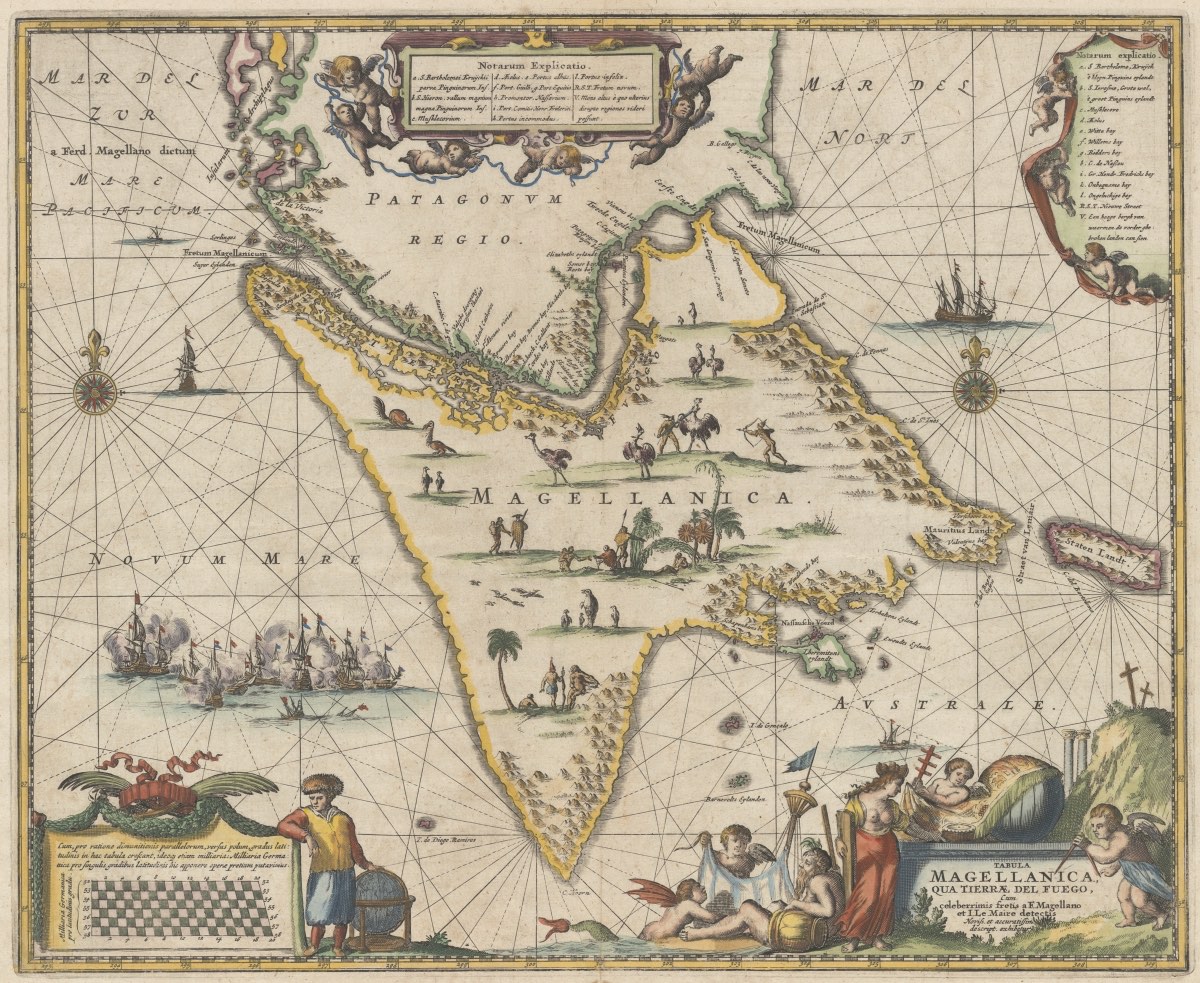
Tabula Magellanica qua Tierrae del Fuego cum celeberrimis fretis a F. Magellano et I. Le Maire detectis Noviss. et accuratissima descriptio exhibeteur, John Ogliby, 1671. A reduced version of the previous map, but an earlier one, from the travelogue by Arnold Montanus in Holland, copied by John Ogilby in England, c. 1675. Cartouches modified, no more local content, but the interior of Tierra del Fuego still full of local animals and people. The dedication has been removed; Staten Landt is delineated as an island in the west but is still not called an island. The reference to the Brouwers passage is not (yet?) there. The depiction of palm-trees is presumably conjecture only.
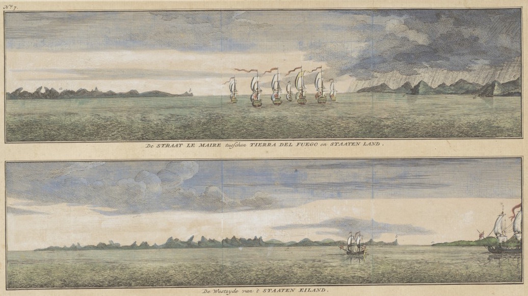
Depicted on a single sheet, are the entrances to the Strait Magellan and Strait Le Maire from a travelogue with the Dutch title ‘Reizen van de Hr. Anson’, published in Amsterdam in Beknopte Handatlas by Isaac Tirion between 1744 and 1769.
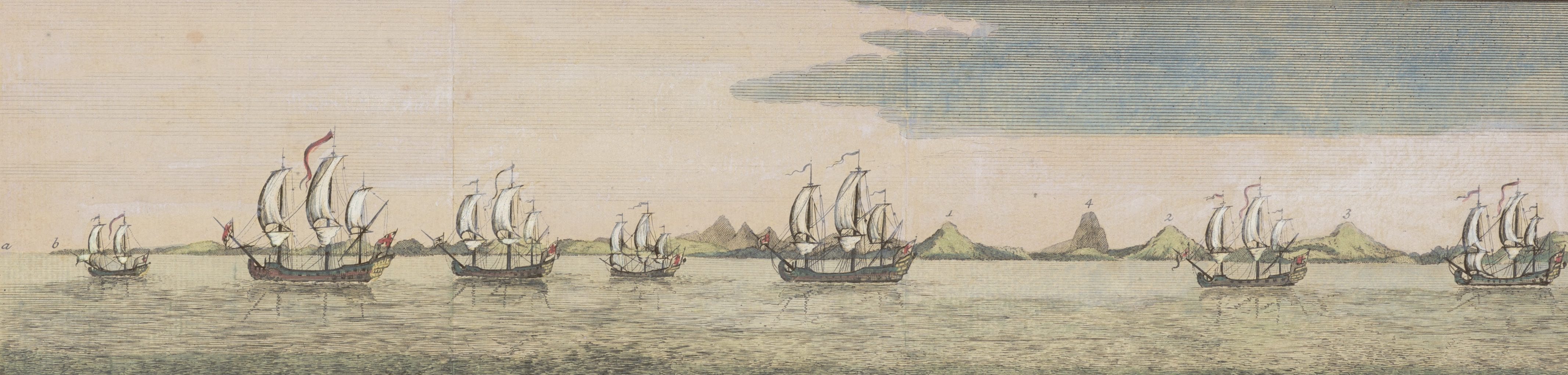
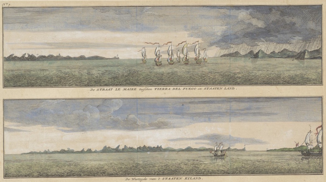
From the same travelogue ‘Reizen van de Hr. Anson’ are illustrations of the land on either side when sailing through the Strait Le Maire – Staten Land on one side and Tierra del Fuego on the other. The lower illustration mentions Staaten Eiland instead of Staatenland and shows its western coastline, obviously from 1643 when Brouwers had established that Staaten Land was not connected to the Southland but an island.
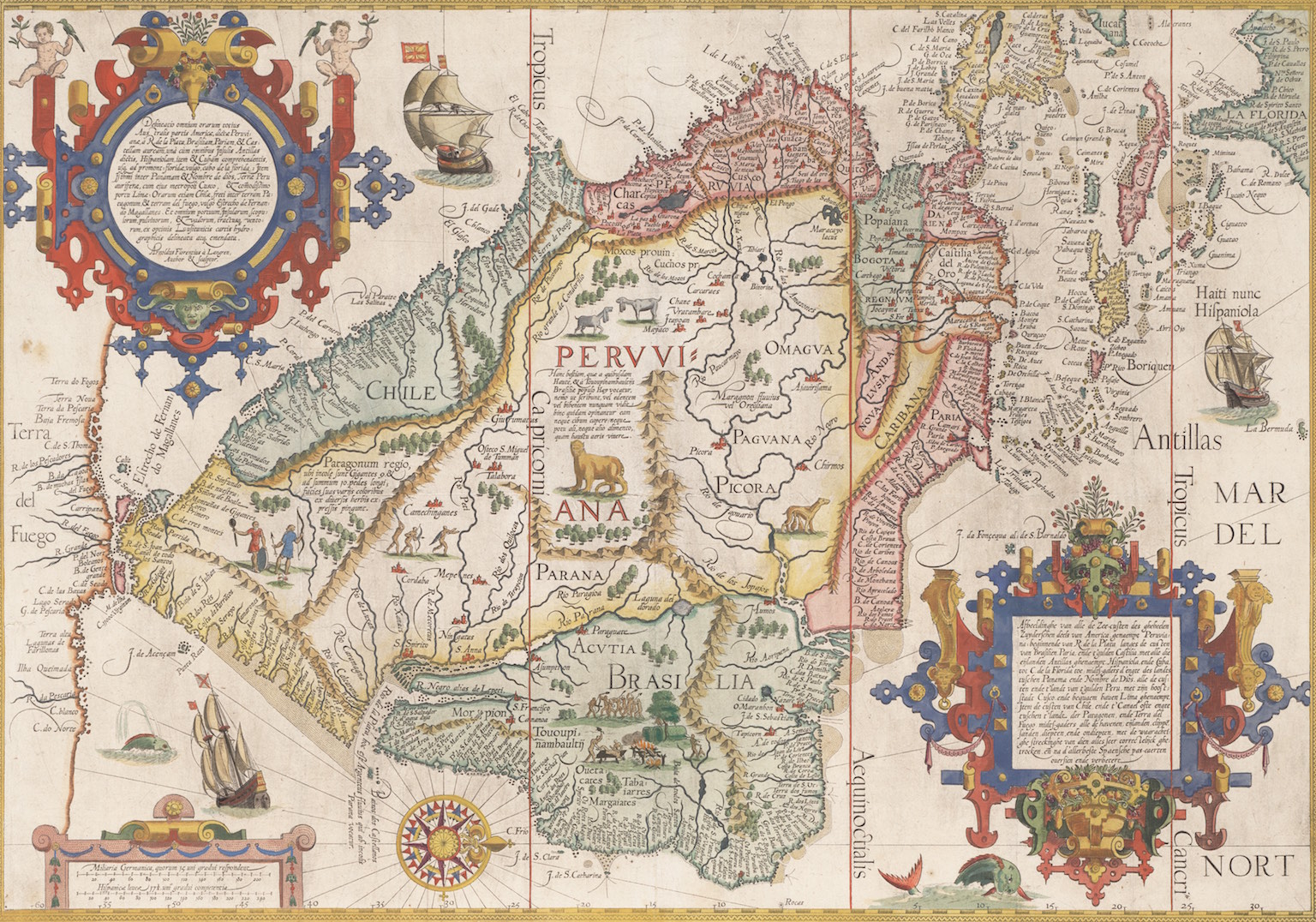
According to the cartouche on the left hand side of the map, it was made and engraved at the end of the sixteenth century by Arnold Floris van Langren. The Dutch Antilles are represented, Parima Lacus is missing and Tierra del Fuego is still part of Terra Australis. The map was produced for Van Linschoten on request of the merchant Dr Paludanus from Enkhuizen.
MC 481
This website uses cookies so that we can provide you with the best user experience possible. Cookie information is stored in your browser and performs functions such as recognising you when you return to our website and helping our team to understand which sections of the website you find most interesting and useful.
These cookies are strictly necessary to provide you with services available through our website and to use some of its features. These must be enabled at all times, so that we can save your preferences.
This website uses Google Analytics to collect anonymous information such as the number of visitors to the site, and the most popular pages.
Keeping this cookie enabled helps us to improve our website.
More information about our Data Privacy Policy.